

Indus Waters Treaty:
Time, March 1948. Place, a village somewhere in West Punjab (Pakistan). News arrives that India will stop the river water. In the agrarian village, the news creates a stir. Among the women, the question arises—will the river water be stopped? Is that even possible? Is the river like a young girl of the household who can be confined inside the house? A village council (panchayat) sits; abusive words about India, including Nehru, emerge from the mouth of the head, and echo from mouth to mouth. In the meantime, a young man speaks up—let us think what we should do; there will be plenty of time to abuse. They are not our friends, so they will not decorate gardens for us; if we were in their place, would we not have done the same? … “Yazid”, Saadat Hasan Manto.
About eight months after independence, in April 1948, a dispute arose between India and Pakistan over the distribution of Indus River water. The government of East Punjab temporarily stops the flow of water to West Punjab of Pakistan through the main branch of the Upper Bari Doab Canal and the Ferozepur Dipalpur Canal.
As a result of the partition of India, the Indus river system, consisting of the Indus and its five tributaries, became divided between India and Pakistan. During the boundary discussions, Sir Cyril Radcliffe had asked whether the river waters could be kept under joint management. But neither the Pakistani nor the Indian representatives in the Boundary Commission agreed to this proposal. As a result, control over the rivers remained under the East Punjab government, that is, the Government of India.
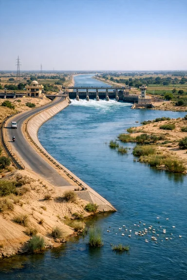
The Ravi and the Sutlej rivers flow from East Punjab to West Punjab. At the time of partition, there was a dam on the Ravi at Madhopur headworks. Water used to flow along the Upper Bari Doab Canal, which supplied water to the cities of Amritsar and Lahore. At the same time, it supplied irrigation water to vast regions of both parts of Punjab. A dam was built on the Sutlej at Ferozepur, whose Dipalpur Canal carried water to West Punjab. The authority to control the flow of these canals was vested in the East Punjab government.
Engineers of East Punjab and West Punjab signed a standstill agreement on 20 December 1947. This meant that water supply to West Punjab during the Rabi crop season would continue until 31 March. West Punjab would pay for it. But before the expiry, Pakistan neglected to negotiate a further agreement, did not pay the dues, and continued anti-India activities. On 1 April, the East Punjab government stopped water supply to West Punjab. At that time, stopping the water supply was one of the major ways of exercising power over each other. When Pakistan agreed to join discussions in an inter-dominion conference, it was resumed, but the Indian step created deep fear in Pakistan, which ultimately led to the signing of the Indus Water Treaty in 1960.
On 22 April 2025, after the brutal killing of 26 Indian tourists along with a local Kashmiri in a terrorist attack in the Baisaran Valley of Pahalgam, Kashmir, the Government of India, on 23 April, declared that “blood and water cannot flow together” and suspended the 1960 treaty on sharing the rivers of the Indus basin between India and Pakistan. Whether this decision is right or not, and whether it is possible or impossible to completely stop the waters of the western rivers, such as the Indus, Jhelum, and Chenab—before coming to that, let us look back at the history of the rivers and water distribution of the Indus basin.
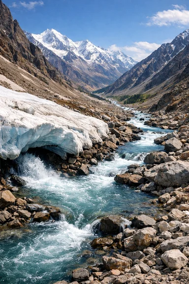
Human civilization follows the course of rivers. Culture and civilization develop on both banks. For example, the great Indus, Vitasta, Krishnaganga, or Chenab, and the sub-Indus rivers of Jammu, Himachal, and Punjab, such as Chandrabhaga, Iravati, Vipasha, and Sutlej. These mountain streams, like arrows, cut through mountains for thousands of years and descend downward, becoming rivers. This cutting creates large valleys, which become the cradle of human civilization.
The Indus basin is the gateway of the Indian subcontinent. The abundance of river water makes it suitable for settlement. Therefore, for thousands of years, human habitation developed there. But no one had the idea of owning rivers. Limited needs may have been a reason.
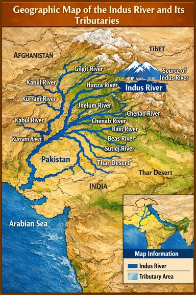
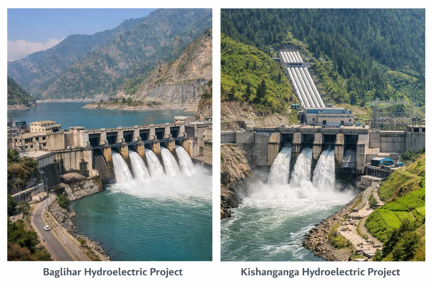
The main rivers of the Indus valley are the western Indus, Jhelum, Chenab, and the eastern Beas, Ravi, and Sutlej. There was also an ancient river, the Saraswati, now lost.
Indus: The Indus (3180 km) originates near Mansarovar in Tibet from the Bokhar-Chu glacier, flows northwest, enters India at Demchok in Ladakh, then flows south into Pakistan near Chilas, and finally into the Arabian Sea.
Jhelum: Originates from Verinag in Jammu & Kashmir, flows northwest, touches Wular Lake, enters Pakistan near Mangla, and joins the Chenab. Length 725 km.
Chenab: About 974 km long, originates from Baralacha La in Himachal Pradesh, splits into Chandra and Bhaga, reunites near Keylong, enters Kashmir and then Pakistan, joining the Indus.
Ravi: 720 km long, originates from Rohtang Pass, flows along the Punjab-Jammu boundary, enters Pakistan near Lahore, and joins the Chenab.
Beas: 470 km long, originates from Beas Kund near Rohtang, flows through Kullu, and joins the Sutlej at Harike.
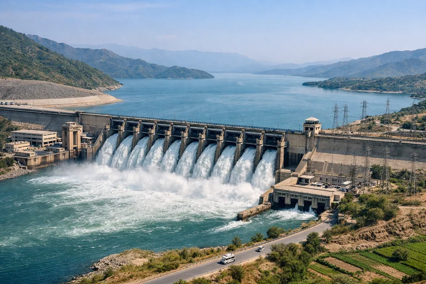
Sutlej: About 1470 km long, originates near Mansarovar from Rakshastal, flows through Himachal and Punjab, joins Beas at Harike. The Bhakra Dam is built on it. Flowing past Ludhiana in Punjab, the Sutlej River merges with the Beas River at a place called Harike. India's largest canal, the Indira Gandhi Canal, originates right from this Harike Barrage.
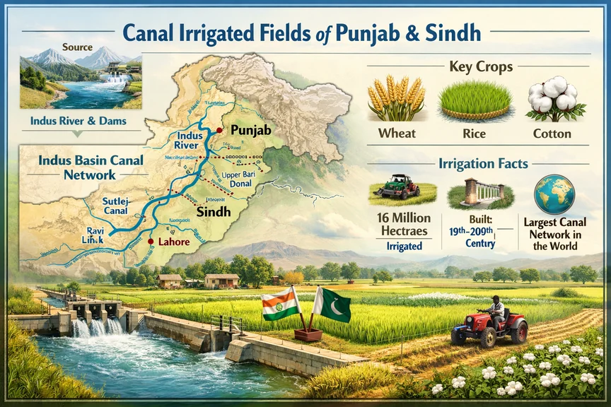
From 1850 to 1947, a network of canals was gradually laid out to connect the rivers of the Indus region (located in present-day India and Pakistan), making the Indus region the most irrigated area in the world. The British—specifically the East India Company—initially established their settlement right on the banks of the Indus River. In the book Blood and Water, David Gilmartin describes how, after settling along the Indus, the British realized that to extend their dominance over this region, particularly in Punjab, they would have to take control of water irrigation through various mechanisms.
In 1845–46, for establishing dominance over the region adjacent to the Sutlej River, near Firozpur, the First Anglo-Sikh War took place. In memory of that war, during the Second World War, the British named their warship HMS Sutlej, and after independence, India named one of its warships INS Sutlej. According to many historians, the war had taken place mainly for the purpose of establishing dominance over the important regions of the vast valley of the Sutlej River. In the books of various contemporary writers, such descriptions are found.
In Alice Albinia’s book Empire of the Indus, the author has said that the English used the rivers of the Indus region to expand their colonialism over the vast region of the Indus. On the bank of the Indus River, Alexander the Great came; on the banks of the rivers, small and big towns were established. These rivers join India and Pakistan, again these rivers themselves are controlled between India and Pakistan for political purposes. Saadat Hasan Manto, in his writing, has written how, with the change of the political context of post-independence India and Pakistan, the news of stopping water supply is spreading fear from village to village.
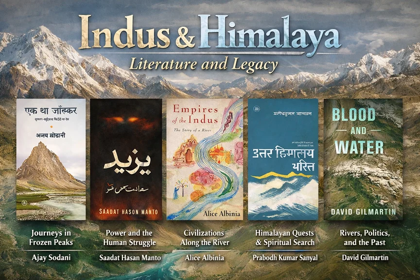
Ajay Sodani, in his book Ek Tha Zanskar, the author shows that from the Mughal period, due to irrigation and by the British, how rivers and their water, for diplomatic purposes, were repeatedly attempted to be controlled by dams and canals, bringing destruction to that region again and again. Along with that, the equation of political and social dominance has also changed. How the construction of dams displaced the people of the region, because of which news of dams would bring fear to that region. Like the present time, in that period also, another name for dams was fear. To the general people, dams were like an enemy.
David Martin, in his book Blood and Water, has mentioned that for millions of years, the rivers of the Indus were spread from the Himalayas to the plains; to common people, they were a gift of God. For ages, no one knew who was the owner of the Indus and the other five rivers. In that region, especially in the Punjab province, over the rights of river water, among kings, maharajas, and various landlords, small and big bloody conflicts continued.
The East India Company and later the British government, from the very beginning, understood that, along with maintaining peace, to maintain dominance, control over the distribution of river water had to be taken into their hands. During the time of Lord Dalhousie, in Punjab, the first PWD was established. In the subsequent phase, after independence, it became known as CPWD. Control over water was transferred from God/Allah into the hands of engineers.
Prabodh Sanyal, in his book Uttar Himachal Charit, writes that regarding Kashmir, for centuries upon centuries, those who have carried out one after another fierce struggles, the root cause of each of those conflicts was to gain control over Kashmir’s approximately two-and-a-half thousand square kilometers of flat, soft, alluvial valley. The Huns, Tatars, Turks, Mughals, Pathans, Afghans, and Iranians—all had that same greed. No one remains satisfied by only occupying the mountains of Kashmir; no one is content even after gaining the forest resources of the mountains—this small valley is what they want. Unfortunately, this age-old conflict has not ended even today.
The author Gilmartin, in the Indus River basin during the Mughal period and the long subsequent British colonial rule, has described the expansion of irrigation through various canals and technologies in this valley, and the impact it had on the social and political life of the people of the region. He has said that the division of water and its effect on political life was something that Jawaharlal Nehru was able to realize at the beginning. He knew that, in this river basin, communal politics based on rights over water and identity linked to water could develop. And that is what happened. Therefore, Nehru kept the Bhakra Nangal Dam outside the Indus Waters Treaty. Because India wanted to retain control over the rivers of the eastern basin of the Indus. In the conflicts over the waters of the valley’s rivers, especially in Punjab province, one of the major demands of the Khalistani movement was rights over rivers and water. That remains in the same way even 77 years after independence.
The struggle and bloodshed over the waters of the rivers of the Indus basin and their rights had been so intense since the pre-independence era that Gilmartin named his book Blood and Water.
Punjabi poet Amrita Pritam writes in her poetry—
"Rise! O narrator of the grieving;
rise! look at your Punjab
Today, fields are lined with corpses,
and blood fills the Chenab
Someone has mixed poison in the five rivers' flow
Their deadly water is, now,
irrigating our lands galore".
After the recent suspension of the Indus water treaty by the central government, a political atmosphere has been created over the sharing of the waters of the Ravi River and Sutlej River in the Indus basin. There is a dispute between two states of India itself—Punjab and Haryana. Punjab has stopped giving water to Haryana from the Ranjit Sagar Dam built on the Ravi River, saying that due to the significant reduction of water in the dam, it cannot supply water to Haryana.
On the Sutlej River lies the Bhakra Nangal Dam. Additionally, the linkage between the Sutlej and Yamuna Rivers has also been a subject of dispute, reaching up to Delhi for a long time.
Between 1850 and 1947, the Indus River basin became one of the most irrigated regions in the world. For that reason, later the central government conducted an experiment in Punjab province on agriculture known as the Green Revolution in India. The consequences and damages of which are still being borne by the farming community of that region today.
Indus Waters Treaty:
As a result of temporarily stopping water in 1948, Pakistan faced the necessity of creating new water channels and, to deal with the emergency situation, engineers were summoned. Passing by Firozpur, by constructing an independent linkage system with the Gopalpur canal, water was transported from the Jhelum and Chenab rivers, and to free from dependence on India-controlled water supply, the Lower Bari Doab link canal, which was eventually named the BRB Canal, was constructed.
In these years, Pakistan’s reaction to India’s water policy brought firmness in claiming water rights based on the doctrines of international law. Despite partition, they continued to imagine unity over a river basin shared with India, yet continued anti-India activities. By 1951, the situation became complicated.
Why the Indus Waters Treaty happened:
As a result of the partition of India in 1947, the Indus river system, which for a long time had irrigated vast agricultural lands, became divided between India (upper rivers) and Pakistan (lower rivers). By 1948, India’s use of river water created fear in the newly formed Islamic republic. At that time, an interim agreement was signed, but Pakistan said it was risky.
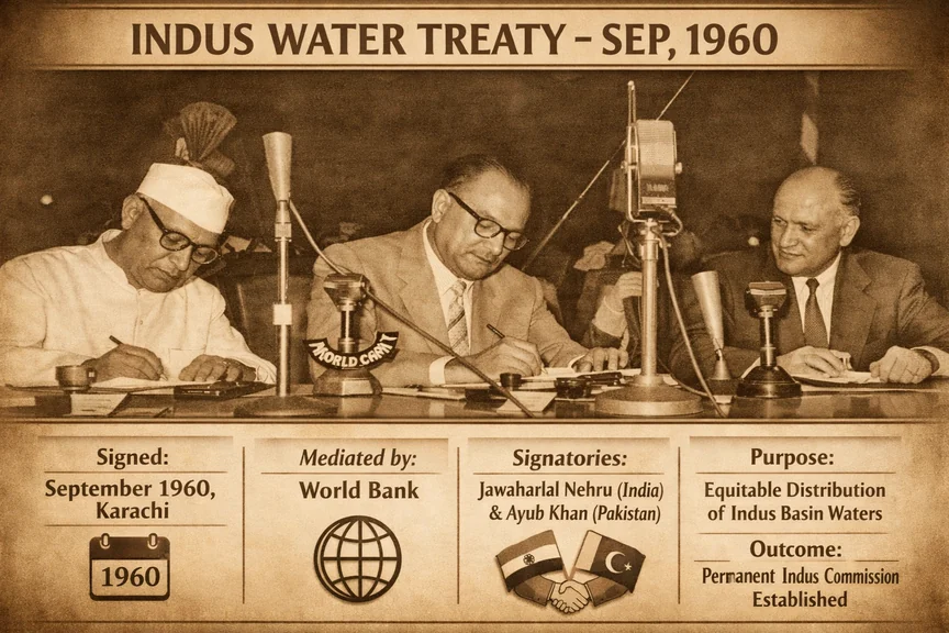
By 1956, Prime Minister Jawaharlal Nehru was preparing to dedicate the Bhakra-Nangal dam on the Sutlej River to the nation; at that time, tension in Pakistan took an intense form, and the risk of war emerged. “Take up arms” and “Black Day” became headlines of Lahore’s Urdu newspapers, as mentioned by Indian negotiator and technical adviser Niranjan Das Gulhati. The challenge was enormous: to share a single integrated water system between two hostile neighbors. The solution took the form of the Indus Waters Treaty, which later became one of the most complex international water-sharing treaties.
Formal proposal and the first obstacle of the Indus Waters Treaty:
With the help of the World Bank, in May 1952, formal discussions officially began. The process gradually moved forward in stages. From 1952 to 1954, a working team of engineers from both countries, along with officials of the World Bank, prepared technical proposals. In 1954, they presented their formal proposal, where a distribution was suggested. India would get exclusive use of the eastern rivers, and Pakistan would get exclusive use of the western rivers.
Pakistan accepted the policy, but for compensation for the water of the eastern rivers, it insisted on a huge replacement plan and demanded a large amount of money as compensation. India said that it would not finance the entire plan. As a result, a deadlock situation was created.
Niranjan Das Gulhati, in his 1973 book Indus Waters Treaty: An Exercise in International Negotiation, mentioned that between 1955 and 1958, discussions were repeatedly postponed; both India and Pakistan remained firm in their positions. Before 1959, no progress seemed possible. In that year, officials of the World Bank—then known as the International Bank for Reconstruction and Development—among whom were the Bank’s President Eugene R. Black and Vice President W. B. Iliff—conducted intensive shuttle diplomacy between New Delhi, Karachi, Washington D.C., and London.
India resisted sharing the financial burden in Pakistan. At the root of Pakistan’s demand for assistance was the loss of water supply duration and access to their networks through the eastern rivers, some headworks of which were then located in India. To survive in agriculture, it became necessary to build new infrastructure to connect with the western rivers.
The estimated cost of the link canals and barrages exceeded one billion. The World Bank began to seek contributions from the major powers. The United States, the United Kingdom, Canada, Australia, New Zealand, and Germany pledged funds. But the agreement could not move forward if India, which had gained exclusive rights over the eastern rivers, did not agree to make any contribution. India initially resisted, but the World Bank argued that India was benefiting by acquiring exclusive rights and therefore should bear a part of the replacement cost. The bankers made it clear that without India’s contribution, the agreement would collapse.
Niranjan Das Gulhati wrote in his book that, before leaving Washington in the third week of April, W. B. Iliff told me that the World Bank would propose to the Prime Minister that India should contribute 250 million dollars as its share towards the cost of construction works in Pakistan. I said that this was too much; it should be limited to 158 million dollars, which we considered fair. Behind closed doors, Iliff and Indian officials, including the then Finance Secretary B. K. Nehru, debated the figures. After much discussion, they settled at 174.8 million dollars, and India would pay this amount in ten equal annual installments until 1970 into the Indus Basin Development Fund, administered by the World Bank. This fund financed large infrastructure projects in Pakistan, such as the Mangla Dam and various link canals. Under the Indus Basin Development plan, India’s contribution was specifically earmarked for Pakistan’s replacement works. Thus, as part of the Indus Waters Treaty, not only water but also money flowed from India to Pakistan.
Final Contributions to the Indus Basin Development Fund:
Contributor Contribution
United States $315 million
World Bank $250 million
United Kingdom $90 million
Canada $70 million
Australia $20 million
West Germany $12 million
New Zealand $6 million
India $62 million (₹80 crore)
Pakistan (Self-financed) $100 million
Total Estimated Cost: Approximately $1 billion
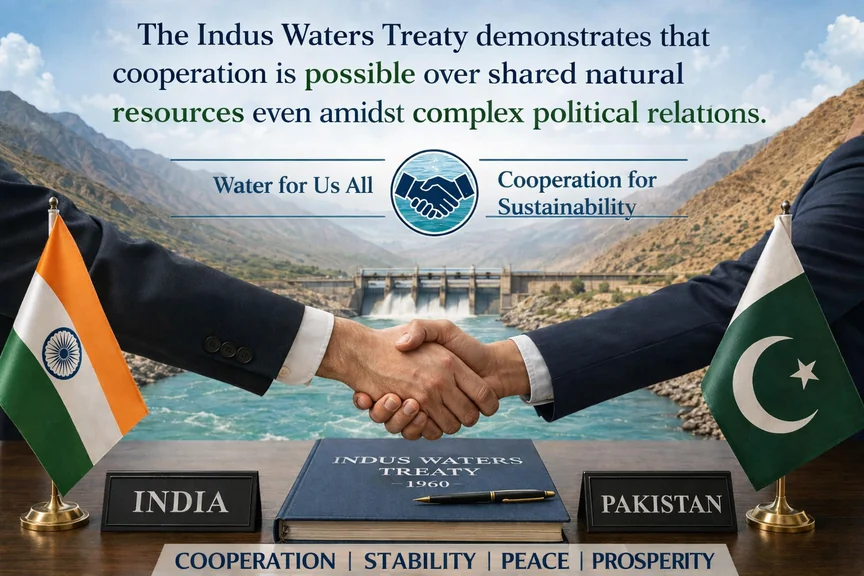
In 1960, India signed the Indus Water Treaty with Pakistan and was globally praised as a victory of water diplomacy. For a single treaty, India not only paid in terms of rivers but also in money financed water infrastructure in Pakistan, and Pakistan has continuously retaliated through hostility.
“I kept working hard to raise funds from various groups and friendly governments. Becoming impatient,” said World Bank President Eugene Black. He further said that in April 1959, he told Indian and Pakistani negotiators that he was forced to break the deadlock over the Indus River water treaty. But time was running out, and even after eight years of negotiations, no possible decision could be reached for a potential Indus Water Treaty.”
Only after India and other donor countries agreed to give one billion dollars (today, 10 billion dollars considering inflation) did this deadlock end. Out of this 10 billion dollars, India gave Pakistan 174 million dollars (today 1.6 dollars). As a result, the path was paved for signing the Indus Water Treaty in 1960. Under the treaty, Pakistan was given exclusive rights over the western rivers such as the Indus, Chenab, and Jhelum, while India retained unrestricted use of the eastern rivers Ravi, Beas, and Sutlej. However, along with crores of gallons of water, millions of dollars from India continued to flow into Pakistan for 10 years as compensation for India’s exclusive rights over the eastern rivers.
After more than six decades, the Indus Water Treaty has again come into discussion. After the horrific terrorist attack in Pahalgam in Kashmir, India announced the suspension of the Indus Water Treaty. Pakistani and Pakistan-trained terrorists killed 26 civilians, most of whom were tourists. New Delhi said that Pakistan’s actions violated the principles of goodwill and friendship of the Indus Treaty. In response to Pakistan’s continuous support for terrorism, the treaty has been kept suspended. This is the first time since its signing in 1960 that India has suspended the treaty.
Although the treaty is currently suspended, as an international norm, it is inappropriate to block the river water flow. But with a neighbor with whom there is a sharing treaty, the Indus Water Treaty is not just a river water treaty; it is also a proposal for peace between two neighboring countries. The suspended treaty has gone beyond its limits.
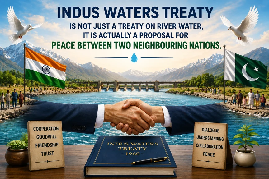
In an era of global warming, when almost all countries are busy with projects to hold back fresh water, the eyes of the world will be on the Indus Water Treaty between two hostile countries, India and Pakistan. The Indus Waters Treaty proves that even amid complex political relations, cooperation in sharing natural resources is possible. It is not just a water distribution treaty; in the regional context, its importance is immense.
Therefore, the Indus Treaty should not be seen as just a simple treaty, but as a large progressive framework which is capable of adapting solutions with time and changing systems. In the coming days, what the renewal of the 2026 water-sharing agreement indicates—that remains to be seen.
Photo Source: AI-generated photos used.


Discussion 1 comment